Maastopyöräreitit
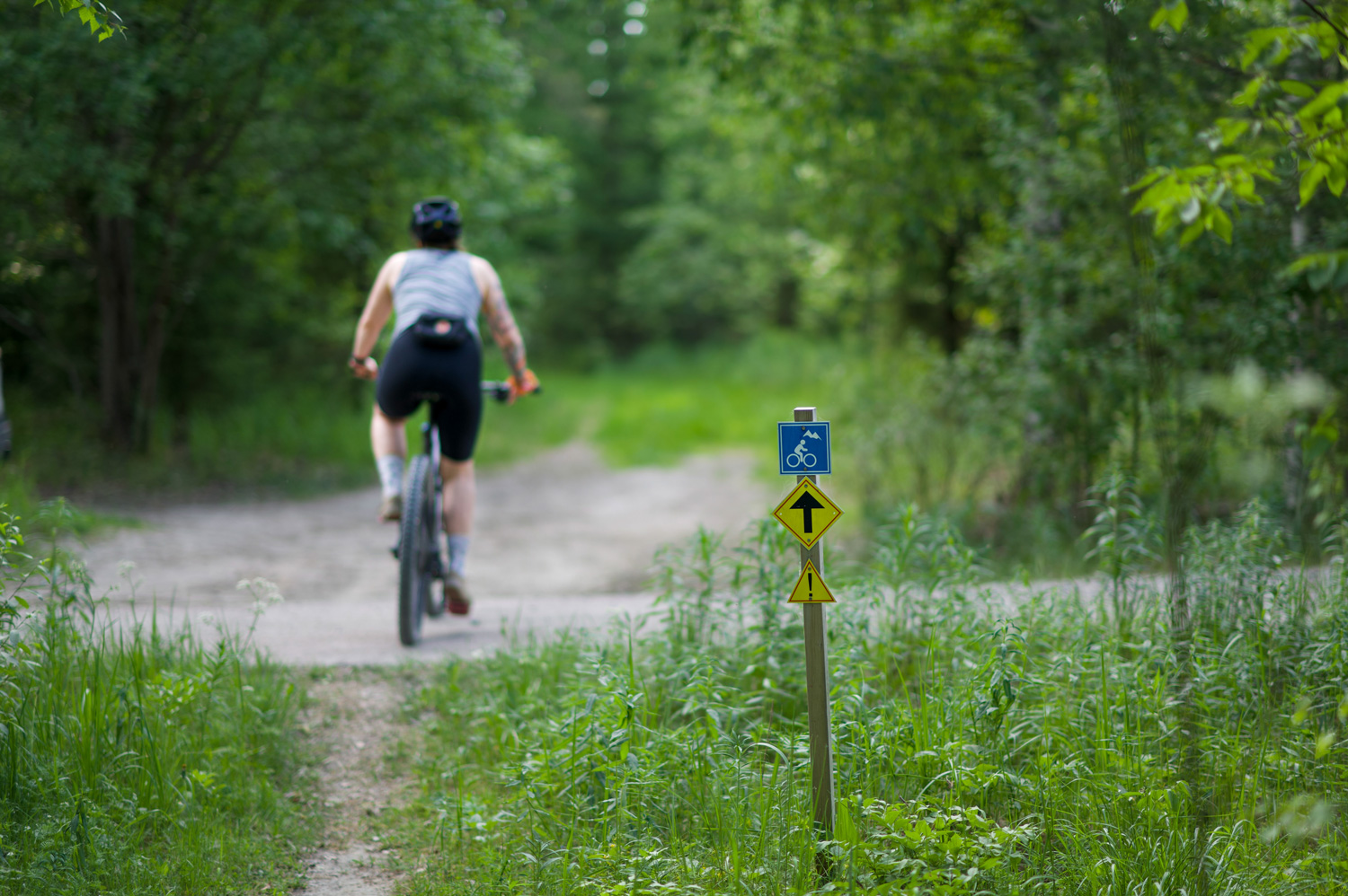
Äänekoskella on Äänemäessä kolme maastopyöräreittiä. Reitit lähtevät laskettelurinteiden juurelta. Muita eritasoisia pyöräilyyn sopivia kohteita ovat Nakertajan ja Liikuntapuiston pururadat, Syvälahden koululta Mörkökoskelle vievä reitti sekä Kaakkovuoren polkuverkosto. Äänekosken ja Suolahden välillä on lisäksi mahdollista liikkua linjan alle raivattu maastopyöräpätkä Paatelan kanavalta Nakertajan pururadalle.
Ajankohtaista
8.8.2025 Äänemäen sininen maastopyöräreitti saatu raivattua. Seuraavaksi siirrytään mustalle ja punaiselle reitille raivaamaan.
31.7.2025. Äänemäen maastopyöräreitille tehdään kesäraivaus elokuun puoleen väliin mennessä. Heinikkoisimmissa paikoissa kannattaa olla keskikesällä tarkkaavainen. Äänemäkeen ajetaan alkusyksyn aikana myös jonkin verran kivituhkaa.
31.7.2025. Suolahden Paatelan maastopyöräreitti on raivattu ensimmäisen kerran ennen juhannusta. Sen jälkeen kanavan päässä on tehty metsähakkuita ja kaukolämpöverkon uusimiseen liittyviä rakennustöitä. Ne tulevat muuttamaan päätieltä Kanavaharjun päälle siirtymistä. Tältä osin uusi reititys odottaa muiden maastotöiden loppumista.
Katso Liikuntapalveluiden poikkeusaikatauluista ja ajankohtaisista asioista Ajankohtaista -sivulta.
Pyörällä saa kulkea metsässä jokamiehenoikeudella, mutta pysy poluilla! Liika kulutus vie maanpinnan mennessään, eikä sammalpeite palaudu hetkessä. Suomen Latu on laatinut yhdessä Metsähallituksen kanssa maastopyöräilijän etiketin, jossa muistutetaan välttämään lukkojarrutuksia ja herkkiä luontokohteita.
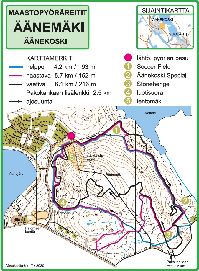
Äänemäen maastopyöräreitit
Lähtöpaikka: Reitistö alkaa Äänemäen parkkipaikan luota. Lähtöpaikalla on pyöränpesupiste. Lähtöpaikan osoite on Äänemäki, Torpparintie 1, 44100 Äänekoski. Lähtöpaikalle on vajaat 2 km Äänekosken keskustan bussiasemalta, joten myös bussilla voi näppärästi saapua esimerkiksi Jyväskylästä tai Viitasaarelta.
Äänemäen maastopyöräilyreitistö tarjoaa pyöräiltävää kaikentasoisille maastopyöräilijöille. Kangasmetsissä kulkevista poluista on valittavissa helppo, haastava tai vaikea reitti oman tason mukaan. Äänemäen maastopyöräilyreitistö kiemurtelee Äänekosken Äänemäen alueella on on pituudeltaan noin 18 km. Reitit kulkevat pitkin kangasmetsiä ja helppokulkuisia ja kuivia maapohjia. Valittavanasi on kolme eri tasoista reittiä: helppo, haastava ja vaikea.
4,3 km mittainen helppo reitti soveltuu aloitteleville maastopyöräilijöille. Reitti on teknisesti pääosion helppo, mutta reitillä on muutamia hankalampia kohtia ja jonkin verran korkeuseroja. Maapohja on hiekkaista kangasta. 5,1 km mittainen haastava reitti kätkee sisäänsä teknisempiä osuuksia ja jonkin verran korkeuseroja sekä kiviä ja juuria. 5,8 mittainen vaikea reitti koostuu kivikoista, vaativista nousuista ja laskuista sekä hyppyreistä. Reitti nousee kolmesta kohtaa ylös Äänemäkeä, josta on upeat näkymät Keiteleelle. Reitistön aloituspiste sijaitsee Äänemäen pysäköintipaikan läheisyydessä.
Reittien korkeusprofiilit (pdf)
Laulavan Mörön polku – Äänekosken Sumiainen
Videopalvelu käyttää evästeitä. Lisätietoa evästeistä.
Katso video Youtubessa. Hyväksy evästeet
Lähtöpaikkana voi olla vaikka Lohilahdentie 4:ssä sijaitseva Leirikeskus. Noin 5,5 km ajon jälkeen on ensimmäinen tulipaikka, kota, Pernalammen ja Mäkilammen välissä. Siitä kannattaa ehdottomasti jatkaa vähintään Väli- ja Jurvonharjulle saakka, joka tarjoaa upeaa harjumaisemaa.
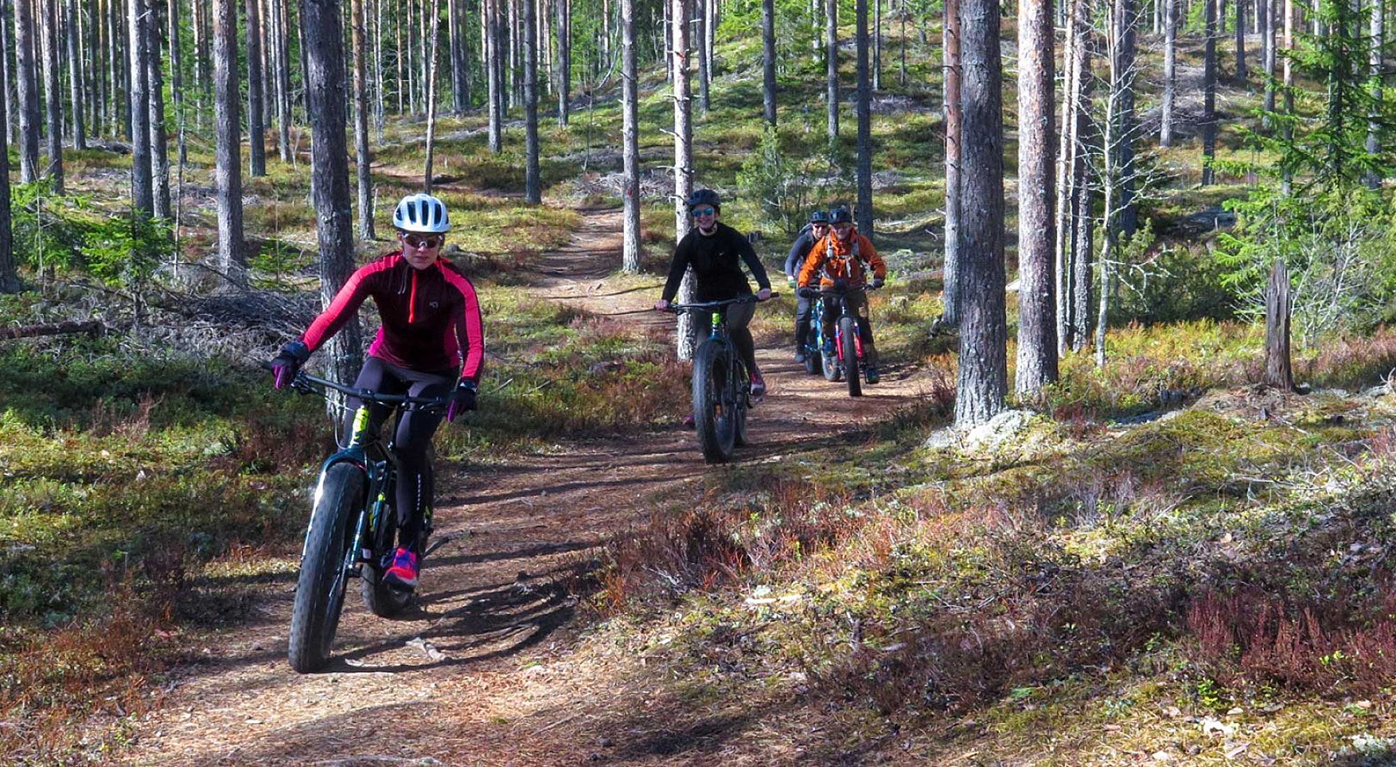
Pituus 36,9 km. Polku on pääosin helppokulkuinen pohjaltaan, joskin jyrkkiä nousuja löytyy, sekä joitakin teknisempiä paikkoja. Polku soveltuu aloittelevalle maastopyöräilijälle ajettavaksi esim. fatbikellä. Polku tarjoaa upeita maisemia, vaihtelevia polkuja ja maastonmuotoja sekä erilaisia metsätyyppejä. Välillä kuljetaan tiiviissä mystisessä kuusikossa, välillä upeita korkeita harjumaastoja.
Matkan varrella Mörkökosken laavu ja Väliharjun kota, reitin äärimmäisessä pohjoispäässä Kettuhiekan tulipaikka. Sumiaistentien ylityksen eteläpuolella erinomainen, viitalla merkitty lähde.
Pohjoinen lenkki Syvälahden vanhalta koululta Laulumäelle on osittain teknisesti kohtuuttoman vaikea, eikä sitä voi suositella kellekään joka ei pidä pyörän kantamisesta. Valitettavasti reitti kannattaa ajaa edestakaisin, alueella ei ole kovinkaan paljon muita polkuja.
Paatela-Suolahti
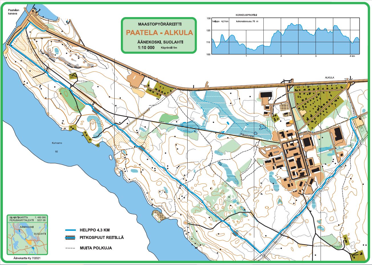
Paatela-Suolahti välin voi liikkua pyöräillen asfaltoitua pyöräilytietä myöten, hiekkatietä vanhaa Pässinrataa myöten tai Pässinradan viereistä linjan alle raivattua maastopyöräreittiä pitkin. Tämä maastopyöräreitti on päästä-päähän reitti, joka toimii hyvin siirtymänä Nakertajan pururadalle.
Ajankohtaista
31.7.2025. Suolahden Paatelan maastopyöräreitti on raivattu ensimmäisen kerran ennen juhannusta. Sen jälkeen kanavan päässä on tehty metsähakkuita ja kaukolämpöverkon uusimiseen liittyviä rakennustöitä. Ne tulevat muuttamaan päätieltä Kanavaharjun päälle siirtymistä. Tältä osin uusi reititys odottaa muiden maastotöiden loppumista.
Lähtöpaikkana voi olla reitin toinen pääty, esimerkiksi Paatelan Portti, josta siirrytään Äänekoski-Suolahti ajotien sillan alta Paatelan kanavan reunaa pitkin hiekkatielle. Kevyenliikenteen väylältä pääsee hiekkatielle suoraan. Hiekkatieltä siirrytään noin 150 m ajon jälkeen metsään alueen korkeimmalle kohdalle, josta avautuu näkymä Kuhnamolle ja alasulutukselle. Toisessa päässä tälle reitille pääsee Nakertajan pururadalta reilun 400 m hiekkatiesiirtymän kautta muuntamon vierestä. Reitille siirtymiset on opastettu.
Pituus 4,3 km helppo. Helpoksi luokitelva reitti kulkee lähinnä kangasmaastoista linjan alustaa, jossa korkeuserot ovat pieniä. Kanavalta noin puolen kilometrin päässä on hieman vaikeakulkuisempi pätkä, jossa ei ihan tavallisella pyörällä välttämättä sateiseen vuodenaikaan läpi tai jos raivaus on siltä kesältä vasta edessä päin. Maastopyörän harrastajille tämä 500 m pätkä ei ole vaikea. Kolmeen kohtaan on pyöräilijöitä varten tehty pitkospuut.
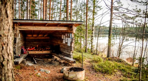
Laavu. Nakertajan pururadan alkupäässä on Hotelli Keiteleen laavu.
